Before the Grid: How Older Roads Leave Traces in a Town
Learn how to read older roads in a town’s street pattern by comparing maps, bends and junctions, and separate visible clues from confident guesses.
An older road can still shape a town long after new streets have covered its edges. To trace older roads in a town, begin with the route’s surviving bends and junctions, then compare those clues with maps and the ground beneath your feet.
The aim is not to identify a single “original” road from one suggestive curve. Instead, build a case from small alignments: a lane that changes direction, a street that meets it obliquely, or a row of plots that seems to follow a path the modern grid ignores. Treat the town plan like a palimpsest: newer lines can obscure an older mark without quite erasing it.
Choose a stretch where the pattern changes
Start with a modest area rather than the whole town. Look for a place where regular streets meet a winding lane, a market street, an old approach to a settlement, or a road that cuts across the grain of newer blocks. The transition is often more revealing than the route’s most picturesque section.
On a current street map, mark the stretch and note its visible features: bends, unusual junction angles, changes in street width, and where the route seems to continue despite a name change. A road’s name can change at a parish boundary or junction, so continuity of direction may matter more than continuity of label.
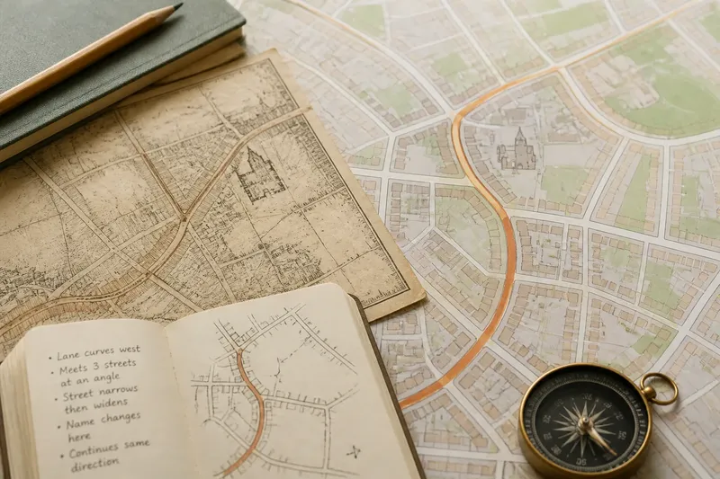
Keep the first pass descriptive. Write “the lane curves west and meets three streets at an angle”, not “this is the medieval road”. That distinction protects the investigation from turning a plausible clue into a conclusion before you have checked it.
Compare maps from different periods
Find a historic town plan or map that covers the same stretch. Local archives, libraries, council map collections and national mapping services may hold useful material. Choose maps with enough detail to show lanes, property boundaries or building plots; a broad regional map may establish a route’s direction but not its relationship to the street pattern.
Compare the old and current maps feature by feature. Look for a line that persists through a later building estate, a bend repeated in a modern street, or a road that once continued into open ground where development has since appeared. If the maps use different scales or orientations, compare landmarks such as a church, square or long-standing junction rather than laying their edges directly over one another.
Record what each map actually shows and what it cannot establish. A mapped road may have been a proposed line, a boundary or a route drawn schematically; the map’s date and purpose matter. If a line vanishes between maps, that may reflect a change on the ground—or simply a different level of detail.
Follow the line through the built fabric
Once the map comparison suggests a route, walk it if access allows. Notice whether the street keeps a consistent direction, where its surface or width changes, and whether newer roads meet it at awkward angles. Observe the town from public streets and paths; private land and closed sites are not necessary to make a useful reading.
Look beyond the carriageway. Building fronts, narrow plots, property boundaries and small passages can preserve the orientation of an older route even where the road itself has been widened or diverted. A row of buildings set at a slight slant to the surrounding grid may be following an earlier line rather than responding to a modern street plan.
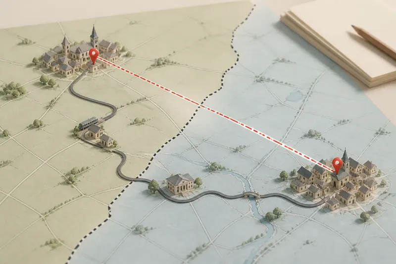
Imagine you are tracing a lane that once entered a small town from the east. On an older map it bends around a churchyard; today, a housing estate fills the nearby fields, but a crescent-shaped street and a line of narrow plots continue the same curve. That combination gives you a reason to investigate the lane’s older alignment, while still leaving open whether every modern feature follows it directly.
Check whether the clues support one another
Test the route against several independent features before describing it as old. A bend alone may reflect a stream, a property line or a later design choice; a road name alone may be much younger than the road. Confidence grows when map evidence, junction geometry and the orientation of plots point towards the same corridor.
- Continuity: Does the line carry on across changes in street name or newer development?
- Junctions: Do later streets meet it at angles that suggest they were fitted around an existing route?
- Plots: Do property boundaries or building rows share its direction?
- Maps: Does more than one map show a related alignment, even if the details differ?
- Ground features: Is there a visible bend, hollow, raised edge or other feature that matches the mapped line?
These are prompts for weighing evidence, not a scoring system. Where maps conflict or the physical clues stop, say so plainly. A careful account might describe a “possible older alignment” rather than assigning the road a precise age or origin that the evidence does not support.
What can an older road reveal?
Why do old roads cut across a modern grid?
A newer street plan may have been laid out over an existing route rather than replacing it completely. The older line can survive as a diagonal street, a boundary or a short connecting lane, while the surrounding blocks follow a more regular plan.
Can a bend prove that a road is old?
No single bend proves age. The curve might reflect a boundary, terrain or a later street design, so compare it with historical maps and neighbouring plot lines before drawing a conclusion.
What if the road name has changed?
Track the physical line through its junctions and direction instead of relying on the name alone. Historic maps and local records may use different labels for connected stretches, or record a name that no longer appears on street signs.
How should uncertain evidence be described?
Use language that matches what you can see: “appears to follow”, “may preserve” or “is consistent with an earlier route”. Distinguish the mapped or observed feature from your interpretation of why it is there.
Write the route as a sequence of observations
When you share your reading, describe the route in order: where it begins, how it bends, which junctions interrupt it, and where the alignment becomes uncertain. This gives another reader a way to check the claim against a map or a walk, without asking them to accept an attractive story as fact.
Use street names as signposts, but include the visible details that connect one segment to the next. If a route appears to continue under a different name, explain the alignment that links them. Keep map dates and uncertainties close to the claims they qualify, rather than burying them in a general note.
Reading older roads in a town is less about uncovering a perfectly preserved line than noticing what newer development had to work around. The most useful trace may be a slight kink at a junction or a row of plots leaning against the grid: small enough to overlook, but clear enough to follow back through the town’s changing shape.